Welcome to the first of a series of blogs about our Creston Valley Green Map project.
What is a green map? Green Maps are used worldwide to highlight nature, culture and other values to create healthier communities. Green Maps have been used to plot biodiversity around villages in Lebanon, or look at connecting city parks in the city of Baltimore. Green Maps are used to create compelling new perspectives on familiar places. They often highlight values that are sometimes left out of discussion, yet are integral to sustainable human communities.
The goal of the Creston Valley Green Map Project is to help decision-makers preserve the exceptional biodiversity of the Creston Valley. The Green Map is also intended as a tool to plan healthy communities. What if our lakes, rivers and creeks continued to be drinkable, swimmable and home to sturgeon, kokanee and burbot? What if our youth had access to a landscape rich in birdsong? What if land planning increased ecosystem resilience in face of climate change? How can we create healthy, sustainable communities that protect our environment, wildlife and water?

The Creston Valley is a hotspot of biodiversity with many species at risk. The area is important for wildlife corridors between the Selkirk and Purcell Mountains. The Creston Valley is also critical for North-South ecological corridors. The Green Map highlights areas where conservation and ecological restoration efforts are most effective. The Creston Valley Green Map characterizes the valley’s habitats for relative importance. The Green Map also shows the human footprint in the valley. The combination of ecological features and social factors reveals areas of high conservation potential. The map suggests where we can encourage the coexistence of humans and wildlife.

Canada has signed the United Nations Convention on Biological Diversity. Canada has a target to protect 17% of terrestrial land and freshwater by the end of 2020 in order to preserve biodiversity. By 2020, local governments are encouraged to integrate biodiversity planning into decision-making. The Creston Valley Green Map can prioritize selection of habitats for sustainable biodiversity targets in the Creston Valley.

The Creston Valley is in the traditional unceded territory of the Yaqan Nukiy people, of the Ktunaxa Nation. The area has been stewarded by the Yaqan Nukiy people for successive generations.
“Since time immemorial, Indigenous Peoples in Canada have been diligent and ingenious cultivators of biological diversity through advanced economic practices that were founded on natural law. Indigenous economies followed Indigenous worldviews, which understand that human systems are a part of, and must remain in balance with, ecosystems. The outcome and effect of theses world views and economic practices was abundant, thriving biological diversity.”
-Eli Enns and Danika Littlechild, Indigenous Circle of Experts Co-Chairs, from “We Rise Together, Achieving Pathway to Canada Target 1 through the creation of Indigenous Protected and Conserved Areas in the spirit and practice of reconciliation, March 2018 Indigenous Circle of Experts’ report and recommendations”
Western colonization has changed the landscape, water and people of the Creston Valley. What voices, values, relationships, and ethics of care are not being represented in land management in the Creston Valley?

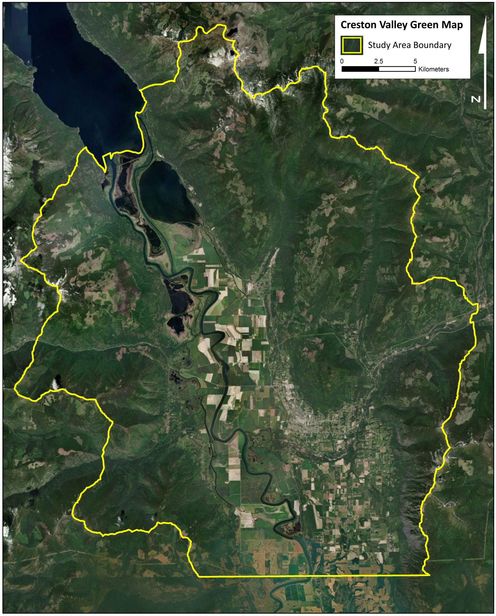
Main Results of the Creston Valley Green Map
Here is an overview of our Green Map results. Areas highlighted by the Green Map have potential for land conservation through stewardship.
The largest areas of current high natural value in the study area are:
- the upper reaches of the Arrow Creek and Duck Creek watershed,
- the northwest facing slopes of Mount Thompson and
- the northern flanks of the Corn Creek watershed.
Valley-bottom high-ranking natural hotspots are riparian habitats. These are concentrated along:
- the lower reaches of the Goat River and Summit Creek
- the east bank of the Kootenay River

Social constraints are high in:
- Creston and Wynndel
- The Lister Plateau, the upper sections of the Goat River, West Creston and most of the lower west-facing slopes between Creston and Kuskanook
- Goat Mountain forms an isolated ‘island’ surrounded by areas of high social constraints
As a community, we can reflect and ask ourselves, are all areas in the valley open for development? Are there places that hold multiple values, and would benefit from a different type of land stewardship or protection? The future of the Creston Valley can unfold in different ways. What future scenarios are rooted in care, connection and healthy communities? The Creston Valley Green Map is most useful when combined with on the ground input and conversations with Yaqan Nukiy, local community members and decision makers.
The next three blog posts will break the Creston Valley Green Map into details. Topics include: building the map, map themes, connectivity and your feedback!
Interested in more? See the green map results and the full green map
Thanks to Yann Troutet, Yellowstone to Yukon Conservation Initiative, Selkirk Geospatial Research Centre for collaborating on this project.