As we approach summer, Wildsight is keeping a close eye on hydrological conditions and dam operations in our region. While poring over graphs, maps and statistics from B.C.’s recent Snow Survey and Water Supply Bulletins, I was reminded of a favourite poem by Rita Wong called Declaration of Intent. In the poem, Wong writes:
“a watershed teaches not only humbleness but climate fluency; the languages we need to interpret the sea’s rising voice.”
With these lines echoing in my mind, I returned to my research with a fresh perspective on what it means to monitor water.
In a time of escalating climate chaos, Wong’s poem is a powerful prescription for what we need to do: build our “climate fluency” so we can understand what is really happening in our world and make the best choices to steer through it.
Wong further writes: “i will apprentice myself to creeks & tributaries, groundwater & glaciers… i will learn through immersion, flotation & transformation; as water expands & contracts, i will fit myself to its ever-changing dimensions.”
So, how can we ‘apprentice’ ourselves to the water that flows through our backyards? How do we become ‘climate fluent’? These are big questions without definitive answers. But, aside from spending time with the water bodies near your home, I’ve listed below three opportunities to start.

1. Skim the latest bulletins from B.C.’s River Forecast Centre, and consider how they connect with current events.
These give a high-level picture of the current water situation both provincially and by sub-region. The May 15 bulletin shows province-wide snowpack below normal for this time of year at 61% of average. The Upper Columbia sub-region is at 77%, West Kootenay is at 68% and East Kootenay is at 32%.
These overall figures are slightly better than last year in Upper Columbia and West Kootenay (not a high bar as 2024 was B.C.’s lowest overall snowpack on record), but are significantly worse for East Kootenay. And, it should be noted, they’re all well below ‘normal’ levels based on historical data.
Zooming in, certain snow stations across our region, including those closest to Golden, Invermere, Kimberley, Cranbrook, Nelson, Creston and Fernie have recently registered levels significantly lower than the overall regional figures.
Province-wide, snow is also melting faster than normal: “By mid-May, typically 19% of the annual B.C. snowpack has melted. As of May 15th… 36% of the seasonal snowpack has already melted.”
To complement the government monitoring network, Living Lakes Canada’s Columbia Basin Water Monitoring Network follows many of the smaller tributaries across our region including ones that communities rely on for water supply. Data from Living Lakes and 50+ other contributors is available on the Columbia Basin Water Hub.

This forecast raises drought concerns and could impact B.C.’s potential for hydroelectricity generation.
Dams in our region (including both the Columbia and Kootenay Rivers) provide almost half of BC Hydro’s total generating capacity. B.C. regularly trades electricity back and forth with the U.S. — and, to a more limited extent, with Alberta — but relies on imports more during drought conditions. With the current forecast, 2025 may be the third year in a row in which B.C. will buy more electricity from the U.S. than it sells. Given tumultuous Canada-U.S. relations and huge electricity demands from expanding the liquified gas and mining industries, B.C. is pushing to increase domestic electricity production and reduce its reliance on imports from the U.S.
That could present difficult considerations for environmental protections, Indigenous Rights and local community input as the province looks to fast track new energy projects and potentially maximize power output from existing ones, like dams in the Columbia River Basin. For example, after years of starts and stops, the provincial government is looking seriously at adding a sixth generating unit to the Revelstoke Dam.

Concern over bills 14 & 15
Alongside criticism from provincial-level Indigenous leaders, ʔaq̓am First Nation (part of the Ktunaxa Nation) in our region has demanded the withdrawal of Bills 14 and 15, which would grant the provincial cabinet authority to expedite any infrastructure project it deems ‘provincially significant’. Wildsight has joined the call for both bills to be withdrawn.
At Wildsight, these overarching trends also make us think about the flexibility negotiated in the Columbia River Treaty Agreement-In-Principle which, if finalized, would allow B.C. to use some storage space in Columbia Basin reservoirs to enhance environmental, Indigenous cultural, and local socioeconomic interests. Dam operations are complex and the ways that different purposes balance and blend with each into releasing water or not at any given time defy simple characterizations. However, in general, if we are managing dam operations to support non-power values, that means we aren’t going to be maximizing power output.
Regardless of what happens with evolving economic and political issues, the government needs to respect its commitments to Columbia Basin communities and Indigenous Nations and ensure that we stay on track to improve local conditions around our region’s reservoirs.

2. Email southern-interior.info@bchydro.com to sign up for BC Hydro’s regular updates on reservoir levels.
Becoming ‘water literate’ means understanding the full journey of water throughout our watershed. And when snow on our mountains melts, any water that’s not absorbed into the ground eventually flows down into one or more reservoirs where dams then hold or release it for various purposes including satisfying Columbia River Treaty obligations to the U.S.
Every Friday, BC Hydro sends subscribers a short email including current water levels in the Arrow Lakes, Duncan and Kinbasket reservoirs, and Kootenay Lake, and forecasts for the week to come. They also sometimes share other periodic updates including about efforts to mitigate and manage impacts to fish and wildlife, recreation, and archaeological resources.
BC Hydro is also holding its annual virtual spring operations meetings soon, on May 28 for the East Kootenay (6:30-8 PM mountain time) and June 18 for the mainstem Columbia (6:30-8 PM pacific time). To register for the East Kootenay meeting, click here; to register for the mainstem Columbia registration, click here.

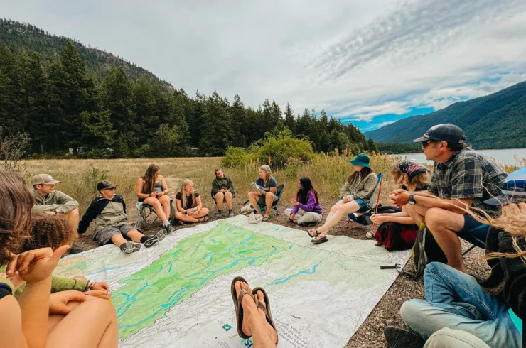
3. Join Wildsight for a Columbia River Conversations Field Tour!
This September, we’re inviting you to camp, explore and learn with us along the Columbia River. Choose from two field tours designed around interactive learning. Participants will learn about the past, present and future of the Columbia River from unique field visits, diverse experts, engaging activities, and through conversation with each other.
- ‘Upper Columbia’ (Revelstoke area): Friday, September 5 – Sunday, September 7
- ‘Lower Columbia’ (Castlegar area): Friday, September 26 – Sunday, September 28
These field tours build on Wildsight’s eight years of experience providing Columbia River educational experiences. In 2018, we launched the Columbia River Field School, a 15-day summer field course for students focused on youth education and engagement around watershed issues. In 2021, we released Teach the Columbia: a curriculum package that makes Field School topics accessible to classroom educators. And, in 2023, we invited government and community leaders to gather with Field School alumni to share knowledge and find connections through this important topic.
As Rita Wong emphasizes in her poem, there’s no better way to learn than through immersion and observation. Field tours are open to people of all ages and professions; please join us in learning from the water that we all depend on.
For more details, and to apply, visit https://wildsight.ca/events/columbia-river-conversations/